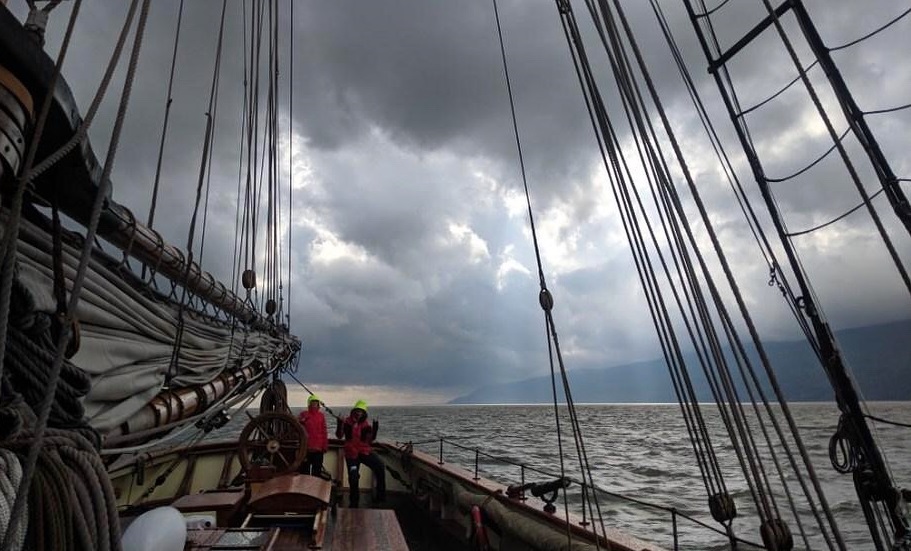
Photo: Cloudy skies over the upper St. Lawrence River, courtesy of Jeff Crosby
Date: Friday, September 6, 2019
Location: Lower St. Lawrence River.
Activity: Moving between night anchorages as we await passage of Tropical Storm Dorian
TS Dorian is expected to cross over Nova Scotia Saturday and Sunday. Dorian has a wide diameter of storm winds. Such is expected to cover most of the width of Gulf of St. Lawrence. We will not be venturing into the Gulf until Dorian passes by. So we dawdle at protective anchorages from local current weather as it changes while we await Dorians’s passing well east of the lower St. Lawrence River.
After a non-stop downriver run of the upper & middle St. Lawrence River (Thousand Islands to Montreal then Montreal to Cap aux Oies, Quebec) we anchored yesterday morning at Ile du Bic. An island on the southern shore of the Lower St. Lawrence near the Quebec town of Rimouski. Time of transit allowance consumed? 3 calendar days out of the allowance of 19.
Reason for anchoring? Tropical Storm Dorian.
As the storm passes over Nova Scotia it will present storm winds all across the Gulf of St. Lawrence. Assuming there is not a surprise move still to be played by Dorian. A storm that has already logged surprises. Therefore we dawdle here rather than risk surprises.
Ile du Bic presented a nice anchorage from decently fresh southwest-west winds. Too bad we could not take advantage of them winds for sailing out of the river … eh?
Those winds have passed now. There is calm today. With a promise of northeast winds tomorrow. No protection from such for our anchorage at Ile du Bic. So we are shifting today to Matane, Quebec.
At Matane is a fortress of a manmade harbor that causes me to think of the fortress walls of Mordor described in the Ring Trilogy. Pride has anchored there before. Shielded from strong northeast winds some years ago during a past transit homeward bound from a summer in the Great Lakes. So here we visit again. New northeast winds are due Saturday, tomorrow. Today we shift and re-position at Matane ahead of the arrival of the forecast northeast winds.
When do we get moving again towards home waters? Early Sunday it seems. As Dorian passes by and heads on away from this area, the strongest winds go away with it and more moderate winds are forecast to fill in behind. The new winds are expected to be favorable for recommencing this voyage home. If all goes as weather oracles suggest, we start out again early Sunday morning bound for home waters. Total dawdle time consumed? Three nights out of a total of eighteen. Or, 16% of total night travel allowance used protecting ourselves from very strong marine weather conditions.
How much distance covered so far? 448 nautical miles. Total overall from Brockville to Baltimore? 1,847 nautical miles. Nearly 25% covered thus far. Using four calendar days. Out of an overall of 19 calendar days or near 21%. So we have 1,399 nautical miles remaining to transit home. But we cannot start till Sunday. This means 12 calendar days to cover 1,399 nautical miles. The standard for estimating required calendar days for transit is 110 nautical miles per day. Remaining mileage divided by remaining time allowance indicates 108 nautical miles per day. Still within feasibility for on-time arrival home. Assuming no significant delays.
Cross your fingers, everyone!
Captain Jan C. Miles