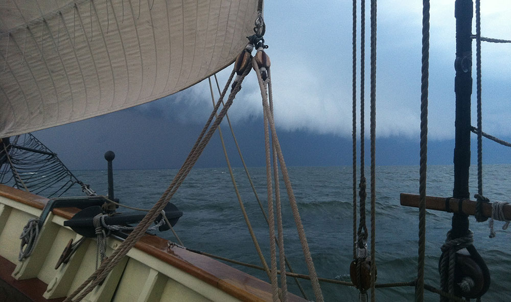
Photo: Squall on the horizon, 2014, courtesy of Patrick Smith
Date: Friday, August 9, 2019
When do the sails get taken in? Might be the quintessential question for all sailors.
The drive to remain sailing for sailors is strong. For traditional working sail rig sailors, it might be strongest. As sailors of the working rigs, there is common knowledge and admiration for the days before any mechanical propulsion was even in the dreams of sailors back in the days of the age of sail. Thus, there can be interest for today’s working sail mariners to emulate.
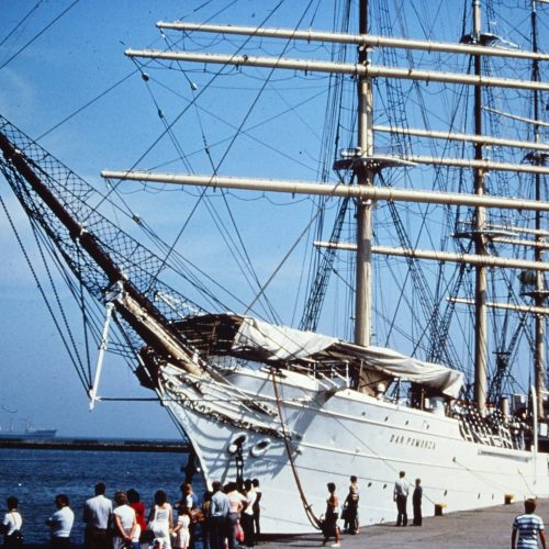
Departing from Kenosha on August 5, there was a light but fair wind to sail with. Knowing of the squall forecast, the sail combination was kept easy and quick to take in and stow. Meaning Pride’s mainsail was not set, nor was her jib. What we nicknamed the “day sail combo” was set: foresail, staysail, and square foretopsail. Out on the smooth Lake Michigan, there was plenty of sail power with this combination. We were making 5 knots on a broad reach with 10 to 12 knots of wind — adequate speed for the time limit and distance to Midland, Ontario, with a deadline of middle of the day Friday.
The motion of the sea is a significant matter when it comes to the amount of sail desired. Not enough for the given sea state and the vessel is rolling and heaving and yawing. Shaking the sails causing, bang, pop, and heaving jerking of inadequate sail area set for the wind speed available. Set some more sail and pretty much most of that jerking and banging and popping will go away. With a smooth lake, the little bit of sail area set remained undisturbed. Performed quietly. So it was pretty easy to skip setting the mainsail and the jib. If a squall threatened, the time it would take to reduce sail would be short. The mechanics of the day sail combo provide for near-complete furling in the process of striking. Specifically, the foresail brails to the mast so the act of taking that sail furls that sail at the same time. The foretopsail is somewhat similar with brail lines that collapse the sail up under the yard. It is not far different than a raised theater curtain, a little loose, but not billowing. A lot of wind can be sustained with a little bit of looseness. Furling more completely to the yard takes two persons, one per yard arm, a mere 5 to 10 minutes to climb up and wrap gasket lines around the mostly brailed-in squaresail and return to deck. Such lashings bring that sail tight to the yard … a whole lot more wind can be sustained when furled with the gaskets. The forestaysail is a typical triangular jib. It has no brail lines, but does have a downhaul that is used to bring the luff of that sail down the length of the forestay. Once down, the staysail can billow if not tied down with its gaskets that are attached to the bowsprit.
So, from the point of view of merely dousing sail, those three sails can be pretty quickly struck and stowed without calling all hands. Instead, handled by the on-watch and the ever-ready standby watch. Leaving the off-watch undisturbed. After dousing sail, some extra time to tie in the staysail. If the wind could be very strong, a bit more time to climb up and sea stow furl the brailed-up squaresail and return to deck.
Squall threat monitoring in our modern age is aided greatly by radar. Rain in the air creates an echo with radar. The degree of density of that echo can be a very general clue to the amount of water in the air. Water in the air is always evaporating. Moisture evaporation is a cooling event to any air mass. That cooled volume of air by the suspended evaporating water creates new weight for that air volume. That air volume drops due to it becoming heavier than the surrounding air that does not have suspended water in it, i.e. no evaporation going on. The dropping air mass can develop significant speed. If/when impacting the surface of water or land, or any obstruction, that fast moving downward air mass is forced to go around or bend horizontally and go along the top of land and water surfaces. Typically, doubling or tripling the pre-existing local wind speeds at the surface. So, 10 knots can easily turn suddenly into 20 to 30 knots of wind for the initial impact experience, suddenly arriving in a gusting manner. In strong squall scenarios, gusts can multiply pre-existing surface wind speeds more than five times. In extreme squall scenarios, there is no multiplier that makes sense. According to deep research done by the National Weather Service starting as far back in time as the 1970s, the “micro-burst” associated with very strong cumulus development can produce a gust front at the surface of more than 50 knots to upwards of 200 knots!!!
Calculating the speed of approach of rain in the air is another thing that radar can assist with. Understanding such speed of advance calculations must be treated with the understanding that squalls are forever changing characteristics. Meaning they cycle through increasing strength phases and decreasing strength phases constantly for as long as there is concentrated cumulus development. Such development are boiling activity in the atmosphere. Hot air, created either from land or water, climbs into the atmosphere from the surface. Rising means the temperature of that hot air rising will at some point start to cool. Moisture in that rising air will begin to condense as the temperature cools. Rising that does not continue past 30 thousand feet height and beyond are not the strongest squall creators. Not when it is a lone sole cumulus development. Those that build to 50 thousand feet and higher can be the source of very strong to extreme squalls. How does one tell the difference? I don’t know, not with conventional shipboard radar. Shore-based weather radar has developed to provide altitude information and much more. That capability requires huge antennae and lots of electrical power. So the sailor at sea with sails set and monitoring rain in the air with radar is stuck with guessing the possible strength of an approaching squall, along with pondering any potential meaning of whatever is the rate of approach.
Sailors wanting to keep sailing and to keep enough sail area up to prevent extreme rolling and heaving and yawing are challenged with guessing when a squall threat will actually arrive. As well as guessing the potential strength when it arrives. This guessing is not completely answered by radar. There are squall scenarios that can push out a wind gust front more than 10 miles ahead of the rain echo. Calculating threat by only assessing the range of the rain echo is risking getting a gust long before the rain.
As things turned out for Pride late Monday evening after departing Kenosha, the three sails set came in ahead of what turned out to be 50+ knots of wind from a totally different side of the ship than had been the sailing direction of wind. The initial gust strength leaned the ship over to near 10 degrees with only her masts and yards and rigging as resistance. The initial maximum strength gust did not last long. And the direction also changed pretty quickly. The initial gusts dropped quickly to around 30 knots for a period of time, no longer from the northeast, but instead from the north. After about a half-hour, wind speed was down below 20 knots and continuing to drop. The direction was backing back toward the northwest. But the rain remained for a couple of hours. After more than three hours, the sky was again clear to the west. The wind was from the south at maybe 10 knots. Pride continued motoring, waiting for better wind, having started motoring as sails were being secured ahead of the radar-indicated suspended water.
Over the following two days, there were several more squalls as Pride made her way eastward through northern Lake Huron. A period of nearly 12 hours of waves of bunched squalls. Radar was chock full of echos. The waves of echoes oriented north-northeast to the south-southwest and tracking west to east. Meaning coming from astern and passing over Pride and carrying on ahead toward the east. Plenty of rain. Not one gust of wind. Yet the onboard radar echo looked the same as was the experience the evening after departing Kenosha.
How to decide about sail area with this truth?
That is the question … ain’t it?
I got a bit of a clue to the difference by having connectivity to the internet. There were warnings on national radar about high wind threats for the squalls the evening after departing Kenosha. No such warnings for the 12 hours of squalls in northern Lake Huron. I left the foresail and the fore-staysail up for the first few hours of those squalls. Because of the need to make more speed, took sail in and pushed toward Pride’s date in Midland, Ontario.
Ocean sailing, with its perennial swells, presents a real challenge to the sailor interested to keep sailing when squalls approach. Sail area is required to both make way as well to damp rolling. But sail area is the cause of angle of heel based on wind speed. So, sometimes the rolling must be accepted, considering it is pretty much impossible to evaluate the strength of squalls by the rain echo seen in the radar.
By the way, there are dry wind gusts: dry squalls that have no moisture clue for radar to bounce off of and show an echo.
We can ask ourselves how, in the days of the age of sail, mariners managed squalls. Probably by a keen eye developed over time and great good fortune … till fortune turned bad.
Captain Jan C. Miles