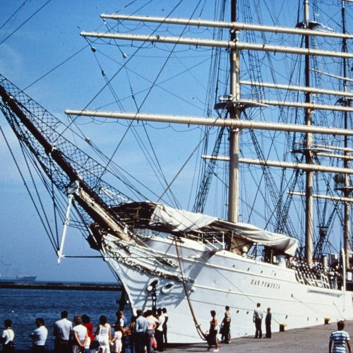
Captain’s Log
Back in May a large schooner in cargo service was hit by suddenly strong winds during the night and sank not far from the northwest side of Great Inagua Island in the Bahamas. Two lives were lost. The survivors described being surprised in the dark by suddenly strong winds.
Everywhere and every day Pride of Baltimore II is underway, and an acute observance of the sky for wind direction and speed changes is ongoing. An additional aid for observing the sky is the RADAR. Because any suspended water or rain creates an echo that can be seen and tracked on the RADAR. One of the phenomena that creates quickly rising wind speeds is rain. Through evaporation air temperature can quickly drop lower in the areas of suspended water or falling rain. The lower-temperature air is heavier than the warmer air. Hence the cooler air falls. Creating a down-burst of air that is faster than the air not affected by rain. Down-burst air from suspended water evaporation can be of speeds between two times the surrounding air speed to more than four times. For example, 10 knot wind can become 20 knots to 40 knots in proximity to suspended water falling and evaporating. Without RADAR, during daylight, the suspended water can be seen as cloud. The more vertical and tall a cloud is, when/if there is a down-burst, it can be stronger than shorter and less vertically formed clouds. Another clue to the possibility of stronger down-bursts is lightening. The color of clouds can offer some clues as well. More grey at the base of clouds can hint at suspended water. Whereas less grey could be less suspended water. Hence less likely to provide rain and the possibility of stronger gusts. Still, the shadow from lower level clouds with less grey color at the bottom can still provide stronger wind speeds, usually of not much additional strength. Maybe only half again the standard wind speed.
For this year’s Annapolis to Bermuda Race, managed by Eastport Yacht Club of Eastport, Annapolis, Maryland, there were few threats from squalls. Not till halfway across from the East Coast to Bermuda did Pride observe the distant presence of clouds possessing possible wind squalls assessed by their appearance during daylight. RADAR was used to check for suspended water echoes. Visibility during a moonless night depended on the regular watch of the RADAR. Moving up and down ranges. At first, any echoes showed up between 20-30 nautical miles distance. Once observed, range and bearing of echoes were monitored to learn if echoes could be tracked toward Pride as she sped along at around 10 knots with favorable wind speeds of high teens. Echo shapes can also provide a sense of potential for down-burst winds. Sharp-edged echoes more than likely means more than doubling of wind speed from down-burst. So, if an echo were to appear to cross over PRIDE, a precautionary attitude would be potential down-bursts of 40+ knots considering standard wind speed was in the high teens. Such a possibility would require reducing sail. During this race, squall management would present the desire to wait till the last moment. Presenting the risk of waiting too long. Reducing sail requires calling the Standby Watch to assist. And calling them again later for resetting PRIDE’s heavy gear after the down-burst wind passed away from Pride.
The first squall was a near miss. Passed by some 3+ nautical miles to windward. Increased wind strength to 30 knots. Without changing wind direction. Being a beam to broad reach, and schooner rigged with a large mainsail and gaff topsail back aft, the main gaff topsail was struck and secured so as to reduce weather helm. Meanwhile angle of heel increased only a little. And speed increased to around 11 knots. Meaning the apparent wind was around twenty. Quite sustainable in terms of the angle of heel and control. The main gaff topsail was not reset as the wind after the squall only reduced to low twenties and Pride was still speeding along at around 10 knots. Steering was much easier. And the angle of heel was more comfortable. Significant heel angles are exhausting to deal with. Pride’s beam of 26 feet means heel angles of near 20 degrees make moving about the deck slow for reason of not falling a distance. 10-15 degrees is a much less demanding angle of heel for an open deck beam of 26 feet.The second squall threat was at night. A line of echoes on the RADAR presenting in a near south-to-north orientation. Tracking indicated that line would cross over Pride. With her more or less coming under the very middle of the line of echoes. As the line of echoes approached wind speed reduced. A phenomenon that comes from suspended water blocking the wind. Meaning suspended water is being pushed by the standard wind. The line of echoes were blocking the wind. As the line of echoes got closer, there was no telling how strong the down-burst might be considering RADAR is not able to show the height of cloud. Only the existence of suspended water. Almost all sail was reduced as the line of echoes on the RADAR approached. Just the fore-staysail was left up. Any strong down-burst would be handled by steering downwind. Or, if not particularly strong, broad reach as a way to keep heading for the race finish. As it turned out, the line of echoes split right over PRIDE. The echoes to the north and to the leeward had lightning. The echoes to the south and windward had 20-25 knots and a slight sprinkle of rain.
For the return to Baltimore, there were three squall threats. The first two were at night and handled by gybing back along the way she had been sailing, meaning reversed direction. To let the tracked echoes pass the intended course toward the Chesapeake Bay. The first reverse was for two nautical miles. The second was for 5 nautical miles before turning back towards the Chesapeake Bay. There was a full moon for the return from Bermuda. The RADAR echoes became quite visible clouds. So, assessable for how vertical development as well as relative height. It was hard to see the horizon under and beyond those clouds. Another indicator of what the suspended water status is. If the horizon is visible under a cloud base, there is no rain falling. So not much evaporation or cooling under the cloud. However, one cannot judge if the visible horizon under a cloud that the RADAR indicates has water suspended means the down-burst is yet to occur or has already occurred. The third squall threat was during daylight. Another line of squalls oriented square to the course Pride was sailing and by RADAR tracking was a line of echoes moving across the intended course. Sail was reduced down to foresail and fore-staysail. Trimmed for beam reach. Providing easy steering towards downwind if winds become strong. Another splitting of echoes and visible clouds providing visible horizon occurred as Pride sailed under the line of echoes/clouds. The increase of wind was relatively slight from high teens to mid-twenties. After the echoes and clouds cleared away behind Pride , more sail was set.
Squall management can present the opportunity of deviating from the intended track without reducing sail. Or both. However, if deviating from track is not navigationally viable, reducing sail is the only option.
During Pride’s travel up the Chesapeake Bay, a night at anchor in the mouth of Patuxent River was had. A comfortable and peaceful situation was interrupted before sunset by a 60-mile-per-hour wind and rain down-burst squall. With cellular access to the internet, we watched the squalls advancing from west to east. More or less aimed at the area of the Chesapeake Bay spanning both the Patuxent and Potomac Rivers. The nature and form of the squalls were large and small clusters spanning widely west to east as well north to south. Meaning not a single line. For a while it looked possible clouds would pass by around PRIDE’s anchorage near the Naval Air Station. In the end, one of those denser cluster echoes passed over Pride and down-burst winds of 60 mph were experienced. A stressful experience for almost half an hour. Pride did drag some 660 feet. Shallow water never got close, but for the time the blow remained a threat raised the specter of needing to either haul back the anchor or let the chain run all the way out to become free to maneuver. Neither option would be quick to execute. Of the two options, throwing the chain would take the shortest amount of time. But also the most dangerous option to crew fingers. Maneuvering with both engines was done. And slowed the dragging down. However the length of time of the down-burst was unknown, hence also anxious making. Being a squall, and not a strong cold front or a deep low pressure, the down-burst would not last a long time. But while it lasted, the mind went to the question of how long would it last. The rest of that night at anchor was an all-night RADAR watch. Through the night, winds were around 10-15 knots. Around 2 AM winds of a passing squall reached 25 knots for less than half an hour. What could have been a different strategy for this widely spread and active squall period? Recognize there would be no means for predicting which cluster of echos would provide a strong down-burst wind experience. Hence not go to anchor with a lee shore. And not remain at anchor with a lee shore. Being underway under power, enables being able to navigate in more open water areas with less risk of having a near by lee shore. Being at anchor without a lee shore means dragging can occur freely. Unpredictability is the reality of wind squalls. Planning to anchor at the end of a full day of crew activity, but not doing so due to concern of strong wind squalls, is a pretty tough call to make. Except with this experience, deciding to pull back the anchor when realizing the wide expanse of squalls and the likelihood one or more could develop into a very strong wind squall, is the call I would choose to make if a similar situation were to be seen to develop while at anchorage.
Signed,
Jan C. Miles, Senior Captain